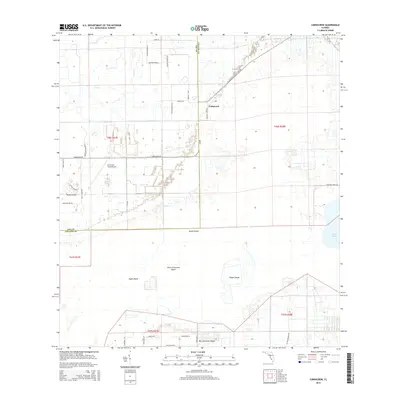
2015 Map of Corkscrew
USGS Topo · Published 2015About this map
Corkscrew serves as the focal point of this southwestern Florida interior, where the transition from agricultural land to residential development is clearly visible. The landscape is defined by its low-lying terrain, punctuated by several large hummocks including Ruess Island and Big Corkscrew Island. These "islands" sit amidst a network of canals and drainage patterns typical of the region's managed hydrology. The map captures a unique mix of rural life and specialized development, such as the Corkscrew Trace Airpark and distinctively named residential spurs like Barefoot Ski Blvd and Happy Dale Ln. To the east, the waters of Lake Trafford sit near the boundary of Lee and Collier counties. This documentation records a moment when traditional land use meets modern expansion, with arterial routes like Corkscrew Rd and the long diagonal of CR-850 providing the primary connectivity through this pocket of the Everglades ecosystem.
Find a feature on this map
38 named features on this map. Tap any name to fly to it.
Don’t see what you’re looking for? This feature index may not catch every label — zoom into the map to look around manually.
Map Details
Editions of this 2015 Corkscrew Map
This is the sole edition of this map. No revisions or reprints were ever made.
Other maps of this area

1956 · West Palm Beach
USGS Topo · 1:250,000

1957 · West Palm Beach
USGS Topo · 1:250,000

1958 · West Palm Beach
USGS Topo · 1:250,000

1958 · Corkscrew SE
USGS Topo · 1:24,000

1958 · Corkscrew NW
USGS Topo · 1:24,000

1958 · Immokalee
USGS Topo · 1:24,000

1958 · Felda
USGS Topo · 1:24,000

1958 · Immokalee SW
USGS Topo · 1:24,000

1958 · Alva SW
USGS Topo · 1:24,000

1958 · Corkscrew SW
USGS Topo · 1:24,000