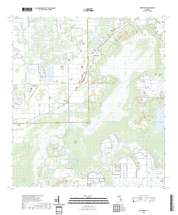
2024 Map of Corkscrew
USGS Topo · Published 2024About this map
Corkscrew Swamp dominates this landscape, defining a vast complex of wetlands and interior island hammocks along the border of Lee and Collier counties. This contemporary survey reveals a mosaic of protected natural terrain and modern rural residential growth. Pockets of development are evidenced by corridors like Corkscrew-Limes Blvd and the Corkscrew Trace Airpark, which sit alongside ancient features like Lake Trafford. The map traces the specific geography of various "islands"—elevated grounds within the wetlands such as Ruess Island, Little Corkscrew Island, and Big Corkscrew Island. Named drainage and marsh features, including Horseshoe Marsh and Poggie Strand, provide a technical look at the hydrological system of this region in the 2020s, showing how modern road networks like Oil Well Grade Rd now navigate the historic swamp boundaries.
Find a feature on this map
41 named features on this map. Tap any name to fly to it.
Don’t see what you’re looking for? This feature index may not catch every label — zoom into the map to look around manually.
Map Details
Editions of this 2024 Corkscrew Map
This is the sole edition of this map. No revisions or reprints were ever made.
Other maps of this area

1956 · West Palm Beach
USGS Topo · 1:250,000

1957 · West Palm Beach
USGS Topo · 1:250,000

1958 · West Palm Beach
USGS Topo · 1:250,000

1958 · Corkscrew SE
USGS Topo · 1:24,000

1958 · Corkscrew NW
USGS Topo · 1:24,000

1958 · Immokalee
USGS Topo · 1:24,000

1958 · Felda
USGS Topo · 1:24,000

1958 · Immokalee SW
USGS Topo · 1:24,000

1958 · Alva SW
USGS Topo · 1:24,000

1958 · Corkscrew SW
USGS Topo · 1:24,000