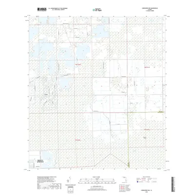
2018 Map of Corkscrew NW
USGS Topo · Published 2018About this map
Bonita Springs and Estero anchor the western edge of this 2018 survey, reflecting the ongoing suburban transition into the interior of Lee County. The landscape is a distinct blend of master-planned communities like those along Wildcat Run Dr and Bella Terra Blvd set against the sprawling wetlands of the Corkscrew Swamp to the southeast. Major corridors such as Corkscrew Rd and Alico Rd provide the primary framework for this growth, cutting through historical agricultural lands like Burgundy Farms Rd. Further south, the map details the transition into Collier County at Panther Island, where the terrain remains dominated by extensive marshland and cypress strands, illustrating the sharp boundary between coastal development and the protected natural systems of the Florida Everglades ecosystem.
Find a feature on this map
40 named features on this map. Tap any name to fly to it.
Don’t see what you’re looking for? This feature index may not catch every label — zoom into the map to look around manually.
Map Details
Editions of this 2018 Corkscrew NW Map
This is the sole edition of this map. No revisions or reprints were ever made.
Other maps of this area

1956 · West Palm Beach
USGS Topo · 1:250,000

1957 · West Palm Beach
USGS Topo · 1:250,000

1958 · West Palm Beach
USGS Topo · 1:250,000

1958 · Corkscrew SE
USGS Topo · 1:24,000

1958 · Bonita Springs
USGS Topo · 1:24,000

1958 · Corkscrew NW
USGS Topo · 1:24,000

1958 · Estero
USGS Topo · 1:24,000

1958 · Alva SW
USGS Topo · 1:24,000

1958 · Corkscrew SW
USGS Topo · 1:24,000

1958 · Alva SE
USGS Topo · 1:24,000