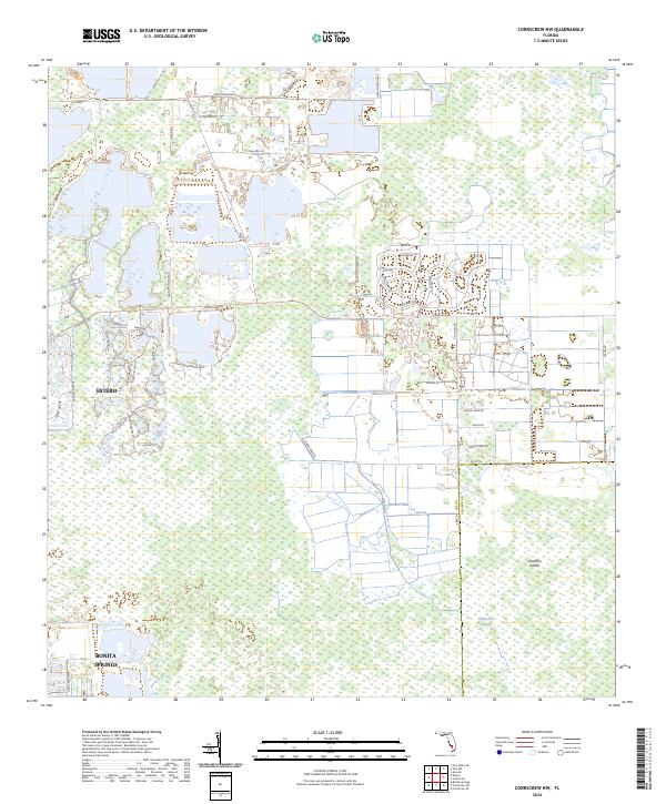
2024 Map of Corkscrew NW
USGS Topo · Published 2024About this map
Corkscrew Swamp and the surrounding Lee County wetlands characterize this modern landscape, where residential development pushes into the Florida interior. Rapid expansion is evident in the residential corridor between Estero and Bonita Springs, where complex networks of cul-de-sacs and private drives like Villa Di Preserve Ln and Bella Terra Blvd replace formerly open terrain. Despite this growth, large tracts of the natural environment remain preserved, notably around Panther Island, showing the ongoing tension between suburban sprawl and ecological conservation. The map details a sophisticated infrastructure of named thoroughfares such as Corkscrew Rd and Alico Rd, which serve as the primary arteries connecting these newer communities to the regional centers of Southwest Florida.
Find a feature on this map
52 named features on this map. Tap any name to fly to it.
Don’t see what you’re looking for? This feature index may not catch every label — zoom into the map to look around manually.
Map Details
Editions of this 2024 Corkscrew NW Map
This is the sole edition of this map. No revisions or reprints were ever made.
Other maps of this area

1956 · West Palm Beach
USGS Topo · 1:250,000

1957 · West Palm Beach
USGS Topo · 1:250,000

1958 · West Palm Beach
USGS Topo · 1:250,000

1958 · Corkscrew SE
USGS Topo · 1:24,000

1958 · Bonita Springs
USGS Topo · 1:24,000

1958 · Corkscrew NW
USGS Topo · 1:24,000

1958 · Estero
USGS Topo · 1:24,000

1958 · Alva SW
USGS Topo · 1:24,000

1958 · Corkscrew SW
USGS Topo · 1:24,000

1958 · Alva SE
USGS Topo · 1:24,000