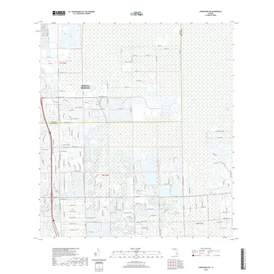
2018 Map of Corkscrew SW
USGS Topo · Published 2018About this map
Bonita Springs defines the western edge of this landscape where residential expansion meets the vast hydrological systems of Southwest Florida. The map illustrates a transitional zone where developed street grids, including Bonita Beach Rd SE and Bonita Grande Dr, terminate into the wetlands of Corkscrew Swamp and Bird Rookery Swamp. This 2018 survey reveals the intricate network of water management and recent suburban platting, featuring educational landmarks like Hodges Univ. Northward, the Imperial River winds through the terrain, while further east, the natural features of Horseshoe Marsh highlight the preservation of the original Florida wilderness. The boundary between Lee County and Collier County bisects the area, marking a significant administrative division in this rapidly evolving region.
Find a feature on this map
141 named features on this map. Tap any name to fly to it.
Don’t see what you’re looking for? This feature index may not catch every label — zoom into the map to look around manually.
Map Details
Editions of this 2018 Corkscrew SW Map
This is the sole edition of this map. No revisions or reprints were ever made.
Other maps of this area

1956 · West Palm Beach
USGS Topo · 1:250,000

1957 · West Palm Beach
USGS Topo · 1:250,000

1958 · West Palm Beach
USGS Topo · 1:250,000

1958 · Corkscrew SE
USGS Topo · 1:24,000

1958 · Bonita Springs
USGS Topo · 1:24,000

1958 · Corkscrew NW
USGS Topo · 1:24,000

1958 · Estero
USGS Topo · 1:24,000

1958 · Belle Meade NE
USGS Topo · 1:24,000

1958 · Belle Meade NW
USGS Topo · 1:24,000

1958 · Corkscrew SW
USGS Topo · 1:24,000