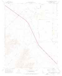
1974 Map of Corn Creek Springs NW
USGS Topo · Published 1977About this map
Lucky Strike Canyon dominates the southwestern corner of this mid-1970s topographical record, where the drainage of Deer Creek descends from the high ground toward the open desert. The landscape is defined by its transition from a military environment to protected natural lands. The Nellis Air Force Range and an indefinite Military Reservation border occupy the northern and central sections, while the eastern portion falls within the Desert National Wildlife Range. Traces of earlier transportation and resource extraction are evident across the valley floor, including an Old Railroad Grade and several scattered Borrow Pits. The presence of the Corn Creek Well (Site) and a network of Jeep Trails indicates the sparse but vital water and access points used in this arid Clark County terrain.
Find a feature on this map
14 named features on this map. Tap any name to fly to it.
Don’t see what you’re looking for? This feature index may not catch every label — zoom into the map to look around manually.
Map Details
Editions of this 1974 Corn Creek Springs NW Map
2 editions found
Other maps of this area

1907 · Las Vegas
USGS Topo · 1:250,000

1908 · Las Vegas
USGS Topo · 1:250,000

1942 · Indian Spring
USGS Topo · 1:125,000

1945 · Sheep Range
USGS Topo · 1:125,000

1952 · Corn Creek Springs
USGS Topo · 1:62,500

1954 · Las Vegas
USGS Topo · 1:250,000

1957 · Las Vegas
USGS Topo · 1:250,000

1957 · Charleston Peak
USGS Topo · 1:62,500

1959 · Las Vegas
USGS Topo · 1:250,000

1962 · Las Vegas
USGS Topo · 1:250,000