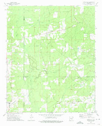
1973 Map of Cornerstone
USGS Topo · Published 1975About this map
Cornerville and Rock Springs anchor this portion of southeast Arkansas in the early 1970s, where the borders of Cleveland, Lincoln, and Drew counties converge. The landscape is defined by an intricate network of waterways, including Tenmile Creek, Mill Creek, and the swampy bottomlands of Beaver Slough. These natural features dictated the placement of early settlements and roads like Rock Springs Road, which connects the small communities dotting the countryside.
Find a feature on this map
25 named features on this map. Tap any name to fly to it.
Don’t see what you’re looking for? This feature index may not catch every label — zoom into the map to look around manually.
Map Details
Editions of this 1973 Cornerstone Map
This is the sole edition of this map. No revisions or reprints were ever made.
Other maps of this area

1935 · Altheimer
USGS Topo · 1:62,500

1935 · Varner
USGS Topo · 1:62,500

1935 · Noble Lake
USGS Topo · 1:62,500

1941 · Goldman
USGS Topo · 1:62,500

1948 · Helena
USGS Topo · 1:250,000

1950 · Helena
USGS Topo · 1:250,000

1955 · Helena
USGS Topo · 1:250,000

1959 · Helena
USGS Topo · 1:250,000

1960 · Helena
USGS Topo · 1:250,000
1964 · Cades
USGS Topo · 1:24,000