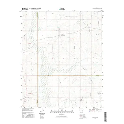
2017 Map of Cornerville
USGS Topo · Published 2017About this map
Cornerville and the surrounding timberlands sit at the complex intersection of Cleveland, Lincoln, and Drew Counties. This 2017 survey details the rural landscape of southeast Arkansas, where the terrain transitions from the elevations of Hardee Hill down into the intricate drainage systems of Beaver Slough and Sevenmile Cr. The map preserves the locations of numerous historic burial grounds essential for family history research, including Newton Chapel Cem and Union Cem Number 2. The settlement pattern follows established county roads and state routes, connecting small communities like Rock Springs and Plantersville. A notable hydrological network of creeks such as Mill Cr and Twomile Cr defines the local topography, influencing the placement of early homesteads and roads that remain the backbone of these rural townships.
Find a feature on this map
56 named features on this map. Tap any name to fly to it.
Don’t see what you’re looking for? This feature index may not catch every label — zoom into the map to look around manually.
Map Details
Editions of this 2017 Cornerville Map
This is the sole edition of this map. No revisions or reprints were ever made.
Other maps of this area

1935 · Feenyville
USGS Topo · 1:62,500

1953 · Greenwood
USGS Topo · 1:250,000

1953 · El Dorado
USGS Topo · 1:250,000

1956 · Greenwood
USGS Topo · 1:250,000

1957 · El Dorado
USGS Topo · 1:250,000

1958 · El Dorado
USGS Topo · 1:250,000

1960 · El Dorado
USGS Topo · 1:250,000

1966 · Monticello North
USGS Topo · 1:24,000
1970 · Calmer
USGS Topo · 1:24,000

1970 · Herbine
USGS Topo · 1:24,000