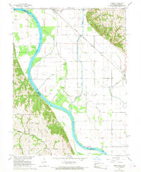
1966 Map of Corning
USGS Topo · Published 1968About this map
The Missouri River defines the western edge of this landscape, carving a wide floodplain shared by Corning and Craig. This 1960s survey documents a highly structured agricultural and transportation corridor where the Chicago Burlington and Quincy railroad tracks run parallel to the Tarkio River. The map captures several small-scale aviation landmarks including Haer Airfield and Craig Airpark, situated near the Old Channel.
Find a feature on this map
34 named features on this map. Tap any name to fly to it.
Don’t see what you’re looking for? This feature index may not catch every label — zoom into the map to look around manually.
Map Details
Editions of this 1966 Corning Map
2 editions found
Other maps of this area

1915 · Falls City
USGS Topo · 1:62,500

1915 · Nemaha
USGS Topo · 1:62,500

1920 · Craig
USGS Topo · 1:62,500

1936 · Fairfax
USGS Topo · 1:24,000

1939 · Tarkio
USGS Topo · 1:62,500

1939 · Nemaha
USGS Topo · 1:62,500

1940 · Tarkio
USGS Topo · 1:62,500

1941 · Tarkio
USGS Topo · 1:62,500

1949 · Nemaha
USGS Topo · 1:62,500

1955 · Nebraska City
USGS Topo · 1:250,000