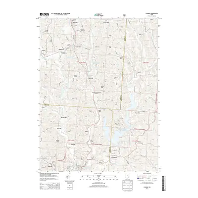
2013 Map of Corning
USGS Topo · Published 2013About this map
The northern reaches of the Wayne National Forest define this 2013 survey of the coal and clay country at the junction of Perry, Morgan, and Athens counties. The topography is dominated by the sprawling Burr Oak Reservoir, while the industrial legacy of the region is traced through the CSX Transportation rail lines that follow the winding path of Sunday Cr. Small settlements like Corning, Rendville, and Glouster are closely clustered, reflecting a history of dense mining communities linked by both rail and road networks.
Find a feature on this map
144 named features on this map. Tap any name to fly to it.
Don’t see what you’re looking for? This feature index may not catch every label — zoom into the map to look around manually.
Map Details
Editions of this 2013 Corning Map
This is the sole edition of this map. No revisions or reprints were ever made.
Other maps of this area

1903 · Athens
USGS Topo · 1:62,500

1904 · Chesterhill
USGS Topo · 1:62,500

1905 · Athens
USGS Topo · 1:62,500

1906 · Chesterhill
USGS Topo · 1:62,500

1910 · Mc Connelsville
USGS Topo · 1:62,500

1911 · New Lexington
USGS Topo · 1:62,500

1947 · Columbus
USGS Topo · 1:250,000

1949 · Clarksburg
USGS Topo · 1:250,000

1956 · Clarksburg
USGS Topo · 1:250,000

1960 · Amesville
USGS Topo · 1:24,000