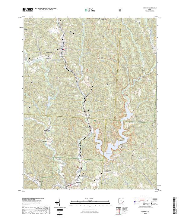
2023 Map of Corning
USGS Topo · Published 2023About this map
Wayne National Forest dominates the hilly terrain of this region, where the industrial legacy of the coal era remains visible in features like the Sunday Cr Coal Company Pond 9420-0. The landscape is defined by the winding valley of Sunday Creek, which connects a series of traditional mining and rail towns including Corning, Rendville, and Glouster. These communities are documented alongside numerous family and church burial grounds, such as Mount Carmel Cem and the Corning Catholic Cem, providing a detailed record for genealogical research. Outdoor recreation and conservation efforts have transformed the area, centered on the Burr Oak Reservoir and an extensive network of footpaths. Long-distance hikers will find the North Country National Scenic Trl crossing the sheet, complemented by local routes like the Wildcat Hollow Trl and the Lake Shore Trl / West Side Of Lake Trl.
Find a feature on this map
87 named features on this map. Tap any name to fly to it.
Don’t see what you’re looking for? This feature index may not catch every label — zoom into the map to look around manually.
Map Details
Editions of this 2023 Corning Map
This is the sole edition of this map. No revisions or reprints were ever made.
Other maps of this area

1903 · Athens
USGS Topo · 1:62,500

1904 · Chesterhill
USGS Topo · 1:62,500

1905 · Athens
USGS Topo · 1:62,500

1906 · Chesterhill
USGS Topo · 1:62,500

1910 · Mc Connelsville
USGS Topo · 1:62,500

1911 · New Lexington
USGS Topo · 1:62,500

1947 · Columbus
USGS Topo · 1:250,000

1949 · Clarksburg
USGS Topo · 1:250,000

1956 · Clarksburg
USGS Topo · 1:250,000

1960 · Amesville
USGS Topo · 1:24,000