Loading...
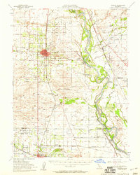
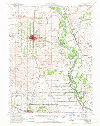
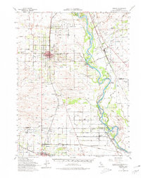
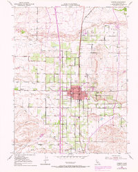
Loading map...1951 Map of Corning
USGS Topo · Published 1959About this map
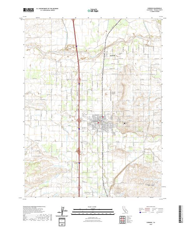
The Sacramento River meanders through the heart of this mid-century landscape, defining the boundary between the agricultural plains and the complex network of sloughs and islands to the east. The primary settlement of Corning serves as a hub for the region's transport, anchored by the Southern Pacific railroad line and a Municipal Airport with a nearby airway beacon. Further south, the town of Orland appears at the edge of the survey, adjacent to Stony Creek and the Orland Auxiliary Airport No 2.
Find a feature on this map
96 named features on this map. Tap any name to fly to it.
Don’t see what you’re looking for? This feature index may not catch every label — zoom into the map to look around manually.
Map Details
Date Portrayed1951
Date Published1959
PublisherU.S. Geological Survey
Map TypeTopographic
Scale1:62,500
Physical Dimensions16.6 x 20.8 inches
Editions of this 1951 Corning Map
3 editions found
Historical Maps of Corning Through Time
6 maps found
Featured Locations
Source Details
SourceU.S. Geological Survey
CopyrightPublic Domain