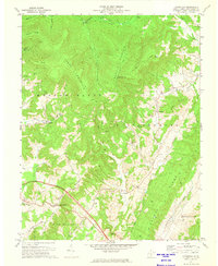
1972 Map of Cornstalk
USGS Topo · Published 1974About this map
Clintonville and Cornstalk anchor the lower elevations of this Greenbrier County landscape, where the rugged topography of Cross Mountain and Buffalo Mountain dictates the patterns of rural settlement. In the early 1970s, the area maintained a distinct spiritual and community character, evidenced by the many small country houses of worship such as New Bethel Ch, Sinking Creek Ch, and Sunrise Chapel.
Find a feature on this map
48 named features on this map. Tap any name to fly to it.
Don’t see what you’re looking for? This feature index may not catch every label — zoom into the map to look around manually.
Map Details
Editions of this 1972 Cornstalk Map
2 editions found
Other maps of this area

1887 · Hinton
USGS Topo · 1:125,000

1887 · Lewisburg
USGS Topo · 1:125,000

1889 · Nicholas
USGS Topo · 1:125,000

1891 · Lewisburg
USGS Topo · 1:125,000

1891 · Nicholas
USGS Topo · 1:125,000

1891 · Huntersville
USGS Topo · 1:125,000

1892 · Hinton
USGS Topo · 1:125,000

1894 · Huntersville
USGS Topo · 1:125,000

1901 · Nicholas
USGS Topo · 1:125,000

1918 · Richwood
USGS Topo · 1:62,500