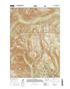
2017 Map of Cornucopia
USGS Topo · Published 2017About this map
Cornucopia sits at the base of the high peaks where the Wallowa National Forest and Whitman National Forest meet. This survey captures a landscape defined by significant water management and alpine terrain, evidenced by numerous high-altitude water bodies like East Lakes Reservoir, Red Mountain Reservoir, and Steele Reservoir. The settlement pattern is concentrated in the southern portion near Cornucopia Peak, while the north is dominated by the drainage systems of the N Fork Imnaha River and S Fork Imnaha River. Geographic features such as Stein Basin, Norway Basin, and Deadman Canyon illustrate the complex drainage network feeding into Pine Cr and its various forks. The presence of Schneider Meadows and names like Boner Flat provide specific points of interest for local historians tracking the geography of this Baker County mining and timber region.
Find a feature on this map
54 named features on this map. Tap any name to fly to it.
Don’t see what you’re looking for? This feature index may not catch every label — zoom into the map to look around manually.
Map Details
Editions of this 2017 Cornucopia Map
This is the sole edition of this map. No revisions or reprints were ever made.
Other maps of this area

1915 · Pine
USGS Topo · 1:125,000

1954 · Cornucopia
USGS Topo · 1:62,500

1954 · Eagle Cap
USGS Topo · 1:62,500

1955 · Baker
USGS Topo · 1:250,000

1955 · Grangeville
USGS Topo · 1:250,000

1957 · Halfway
USGS Topo · 1:62,500

1957 · Sparta
USGS Topo · 1:62,500

1959 · Baker
USGS Topo · 1:250,000

1959 · Grangeville
USGS Topo · 1:250,000

1981 · Baker
USGS Topo · 1:100,000