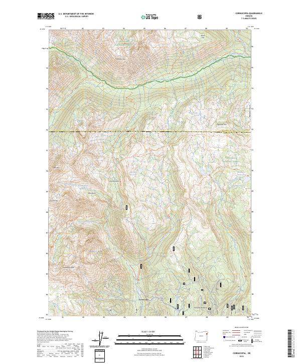
2023 Map of Cornucopia
USGS Topo · Published 2023About this map
Cornucopia sits at the southern edge of this high-elevation landscape, positioned where the steep slopes of the Wallowa Mountains meet a complex network of alpine creeks. The geography is defined by a deep transition from the peak of Cornucopia Peak and Granite Mtn down into glacial basins like Norway Basin and Stein Basin. This 2023 survey documents a wilderness environment managed by the Eagle Cap Wilderness and surrounding National Forest lands, where the hydrologic patterns are clear through the numerous alpine reservoirs such as East Lakes Reservoir and Mehlhorn Reservoir. To the north, the Imnaha Wild and Scenic River carves a significant corridor through the terrain, fed by tributaries including Cliff Creek and Blue Creek. The presence of established trails like the South Fork Imnaha Trl and Schneider Mtn Snowmobile Trl indicates the area's continued importance for mountain access and high-country recreation.
Find a feature on this map
60 named features on this map. Tap any name to fly to it.
Don’t see what you’re looking for? This feature index may not catch every label — zoom into the map to look around manually.
Map Details
Editions of this 2023 Cornucopia Map
This is the sole edition of this map. No revisions or reprints were ever made.
Other maps of this area

1915 · Pine
USGS Topo · 1:125,000

1954 · Cornucopia
USGS Topo · 1:62,500

1954 · Eagle Cap
USGS Topo · 1:62,500

1955 · Baker
USGS Topo · 1:250,000

1955 · Grangeville
USGS Topo · 1:250,000

1957 · Halfway
USGS Topo · 1:62,500

1957 · Sparta
USGS Topo · 1:62,500

1959 · Baker
USGS Topo · 1:250,000

1959 · Grangeville
USGS Topo · 1:250,000

1981 · Baker
USGS Topo · 1:100,000