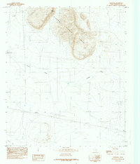
1984 Map of Cornudas
USGS Topo · Published 1985About this map
Cornudas sits as a primary point of human activity in this West Texas landscape, positioned south of the prominent Sierra Tinaja Pinta mountains. This 1980s provisional survey illustrates a high-desert environment defined by arroyos and mountain peaks, including Miller Mountain and the curving ridges of the Sierra. The map details a ranching and transport infrastructure, noted by the Landing Strip and numerous water features like Washburn Tank and various wells critical for habitation in this arid terrain.
Find a feature on this map
19 named features on this map. Tap any name to fly to it.
Don’t see what you’re looking for? This feature index may not catch every label — zoom into the map to look around manually.
Map Details
Editions of this 1984 Cornudas Map
This is the sole edition of this map. No revisions or reprints were ever made.
Other maps of this area

1903 · Cerro Alto
USGS Topo · 1:125,000

1943 · Tepee Butte
USGS Topo · 1:62,500

1943 · San Antonio Mtn
USGS Topo · 1:62,500

1951 · Red Hills
USGS Topo · 1:62,500

1954 · Van Horn
USGS Topo · 1:250,000

1955 · Cerro Diablo
USGS Topo · 1:62,500

1958 · Van Horn
USGS Topo · 1:250,000
1978 · Molesworth Mesa South
USGS Topo · 1:24,000
1979 · Molesworth Mesa North
USGS Topo · 1:24,000
1984 · Mickey Draw West
USGS Topo · 1:24,000