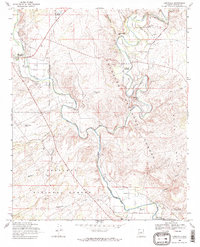
1968 Map of Cornville
USGS Topo · Published 1971About this map
Oak Creek and the Verde River converge in this high-desert landscape, creating a fertile corridor that has long supported habitation and agriculture. The 1960s irrigation network is highly visible through systems like the Oak Creek Ditch and Eureka Ditch, which redirect water to local homesteads and ranching operations. The area is anchored by the settlement of Cornville, while the Camp Verde Indian Reservation and the Middle Verde Cem (Yavapai-Apache) at the southern edge of the quadrangle signify the enduring indigenous presence in the Verde Valley. Cultural history is etched into the terrain at the Sugarloaf Ruins and the rural Oak Creek Sch. Modern infrastructure, including the Fish Farm and the Radio Tower (KVOI) near Bridgeport, contrasts with the vast protected lands of the Coconino National Forest and Prescott National Forest.
Find a feature on this map
39 named features on this map. Tap any name to fly to it.
Don’t see what you’re looking for? This feature index may not catch every label — zoom into the map to look around manually.
Map Details
Editions of this 1968 Cornville Map
2 editions found
Other maps of this area

1887 · Verde
USGS Topo · 1:250,000

1887 · Prescott
USGS Topo · 1:250,000

1892 · Verde
USGS Topo · 1:250,000

1892 · Prescott
USGS Topo · 1:250,000

1905 · Jerome
USGS Topo · 1:125,000

1923 · Camp Verde
USGS Topo · 1:125,000

1932 · Camp Verde
USGS Topo · 1:125,000

1936 · Camp Verde
USGS Topo · 1:125,000

1944 · Clarkdale
USGS Topo · 1:48,000

1944 · Mingus Mountain
USGS Topo · 1:62,500