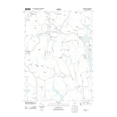
2012 Map of Cornwall
USGS Topo · Published 2012About this map
Green Mountain and Mohawk Mountain anchor this landscape of the Connecticut highlands, where the Housatonic River carves through the northwest. Small hamlets and named intersections like Emmons Corners, Hitchcock Corners, and Kellogg Corners define the settlement pattern, reflecting a history of local kin and land ownership. The area maintains its rural character with significant recreational and protected spaces, including the Housatonic Boy Scout Reservation, Camp Mohawk, and the Mohawk Mountain Ski Area near The Pinnacle.
Find a feature on this map
175 named features on this map. Tap any name to fly to it.
Don’t see what you’re looking for? This feature index may not catch every label — zoom into the map to look around manually.
Map Details
Editions of this 2012 Cornwall Map
This is the sole edition of this map. No revisions or reprints were ever made.
Other maps of this area

1892 · Winsted
USGS Topo · 1:62,500

1892 · Cornwall
USGS Topo · 1:62,500

1892 · New Milford
USGS Topo · 1:62,500

1893 · Waterbury
USGS Topo · 1:62,500

1893 · New Milford
USGS Topo · 1:62,500

1893 · Cornwall
USGS Topo · 1:62,500

1903 · Cornwall
USGS Topo · 1:62,500

1904 · New Milford
USGS Topo · 1:62,500

1904 · Waterbury
USGS Topo · 1:62,500

1904 · Litchfield
USGS Topo · 1:125,000