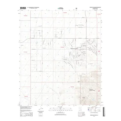
2014 Map of Corona De Tucson
USGS Topo · Published 2014About this map
Corona De Tucson sits at the heart of this Pima County landscape, where suburban residential development meets the rising elevations of the Santa Rita Mountains. The street grid reflects a period of expansion, with named thoroughfares like E Sahuarita Rd and E Andrada Rd providing the framework for growing neighborhoods. To the south, the terrain transitions into the protected lands of the Coronado National Forest, where the topography becomes significantly more complex. In this southern sector, the desert floor gives way to the natural drainage of Sycamore Canyon and the site of Sycamore Spring. The map documents a specific moment in Arizona's modern growth, contrasting the rectilinear planning of the desert valley with the high-relief wilderness of the national forest boundary.
Find a feature on this map
48 named features on this map. Tap any name to fly to it.
Don’t see what you’re looking for? This feature index may not catch every label — zoom into the map to look around manually.
Map Details
Editions of this 2014 Corona De Tucson Map
This is the sole edition of this map. No revisions or reprints were ever made.
Other maps of this area

1904 · Patagonia
USGS Topo · 1:125,000

1904 · Tucson
USGS Topo · 1:125,000

1905 · Patagonia
USGS Topo · 1:125,000

1905 · Tucson
USGS Topo · 1:125,000

1926 · Helvetia
USGS Topo · 1:62,500

1948 · Tucson
USGS Topo · 1:62,500

1956 · Nogales
USGS Topo · 1:250,000

1956 · Tucson
USGS Topo · 1:250,000

1957 · Tucson
USGS Topo · 1:62,500

1957 · Rincon Valley
USGS Topo · 1:62,500