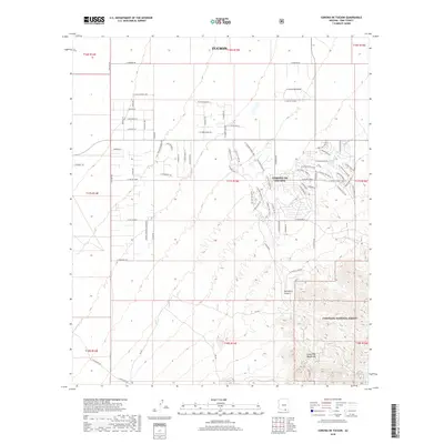
2018 Map of Corona De Tucson
USGS Topo · Published 2018About this map
Corona De Tucson sits at the northern edge of this desert landscape, where suburban expansion meets the rising foothills of the Santa Rita Mountains. The topography transitions from the relatively flat terrain of the Tucson basin into the complex drainage systems of the Coronado National Forest, notably around Sycamore Canyon. This survey captures a moment of modern residential development defined by a dense network of local roads such as E Cam Del Toro and E Andrada Rd, contrasted against the primitive forest routes deeper in the mountains. Local history and geography are preserved in labels like Sycamore Spring and the old alignment of S Helvita-Vail Rd, which once connected these foothills to the broader Santa Cruz Valley. The presence of Forest Service roads like RD 424 and RD 024 indicates the transition from private land to public protected wilderness.
Find a feature on this map
44 named features on this map. Tap any name to fly to it.
Don’t see what you’re looking for? This feature index may not catch every label — zoom into the map to look around manually.
Map Details
Editions of this 2018 Corona De Tucson Map
This is the sole edition of this map. No revisions or reprints were ever made.
Other maps of this area

1904 · Patagonia
USGS Topo · 1:125,000

1904 · Tucson
USGS Topo · 1:125,000

1905 · Patagonia
USGS Topo · 1:125,000

1905 · Tucson
USGS Topo · 1:125,000

1926 · Helvetia
USGS Topo · 1:62,500

1948 · Tucson
USGS Topo · 1:62,500

1956 · Nogales
USGS Topo · 1:250,000

1956 · Tucson
USGS Topo · 1:250,000

1957 · Tucson
USGS Topo · 1:62,500

1957 · Rincon Valley
USGS Topo · 1:62,500