Loading...
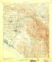
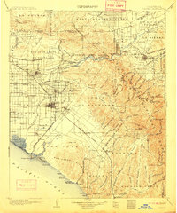
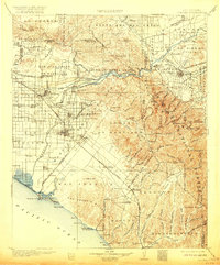
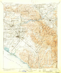
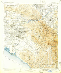
Loading map...1902 Map of Corona
USGS Topo · Published 1905About this map
Santa Ana River valley life at the turn of the century is defined by a complex irrigation network, featuring the Anaheim Canal, Yorba Canal, and Orange and Santa Ana Canal feeding the region's early agricultural growth. This landscape shows the transition from the large rancho era to a modern citrus and rail economy, with the Southern Pacific Railroad and Southern California Railway connecting hubs like Anaheim, Orange, and Fullerton.
Find a feature on this map
126 named features on this map. Tap any name to fly to it.
Don’t see what you’re looking for? This feature index may not catch every label — zoom into the map to look around manually.
Map Details
Date Portrayed1902
Date Published1905
PublisherU.S. Geological Survey
Map TypeTopographic
Scale1:125,000
Physical Dimensions16.5 x 19.9 inches
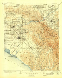
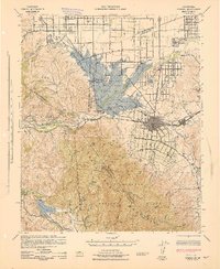
Editions of this 1902 Corona Map
7 editions found

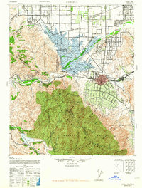
Historical Maps of Anaheim Through Time
3 maps found
Featured Locations
Source Details
SourceU.S. Geological Survey
CopyrightPublic Domain