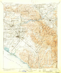
1902 Map of Corona
USGS Topo · Published 1930About this map
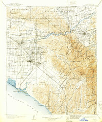
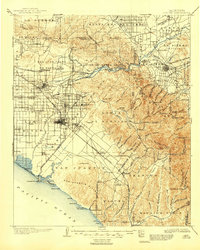
The Santa Ana River carves through this landscape at the turn of the century, providing a vital artery for the emerging agricultural and industrial growth of the region. Irrigation infrastructure is prominently displayed, with the California Canal, Yorba Canal, and Orange and Santa Ana Canal diverting water to support the citrus groves and settlements of the plains. Early communities like Anaheim, Fullerton, and Orange appear as concentrated hubs, while the Southern Pacific R.R. and its various branches, including the Smeltzer Branch, connect these towns to the coast at Newport.
Find a feature on this map
124 named features on this map. Tap any name to fly to it.
Don’t see what you’re looking for? This feature index may not catch every label — zoom into the map to look around manually.
Map Details
Editions of this 1902 Corona Map
7 editions found

Other maps of this area

1894 · Los Angeles
USGS Topo · 1:62,500

1894 · Pomona
USGS Topo · 1:62,500

1896 · Santa Ana
USGS Topo · 1:62,500

1896 · Pasadena
USGS Topo · 1:62,500

1896 · Anaheim
USGS Topo · 1:62,500

1896 · San Bernardino
USGS Topo · 1:62,500

1896 · Las Bolsas
USGS Topo · 1:62,500

1896 · Downey
USGS Topo · 1:62,500

1897 · Pomona
USGS Topo · 1:62,500

1897 · Cucamonga
USGS Topo · 1:62,500