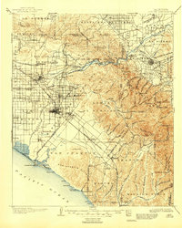
1942 Map of Corona
USGS Topo · Published 1963About this map
The Prado Flood Control Basin serves as a focal point of this Inland Empire landscape, where the confluence of Chino Creek and the Santa Ana River meets the massive engineering of Prado Dam. This 1940s-era geography captures the region during a period of transition, featuring the grid-like agricultural developments near Norco and the established town center of Corona. Significant institutional landmarks include the California Institution for Men and the Rancho Santa Ana Botanic Gardens along the canyon floor. To the south, the terrain rises sharply into the Santa Ana Mountains, revealing a network of remote sites such as Hidden Ranch and peaks like Sierra Peak. Rail history is well-represented by the Pacific Electric Railway and the Atchison Topeka and Santa Fe, which track the routes of early twentieth-century commerce through the Temescal Wash.
Find a feature on this map
77 named features on this map. Tap any name to fly to it.
Don’t see what you’re looking for? This feature index may not catch every label — zoom into the map to look around manually.
Map Details
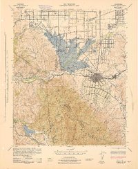
Editions of this 1942 Corona Map
2 editions found

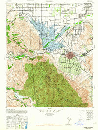
Historical Maps of Anaheim Through Time
3 maps found