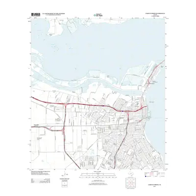
2013 Map of Corpus Christi
USGS Topo · Published 2013About this map
Nueces Bay and the industrial corridors of the Nueces River delta define this coastal landscape. The map details a complex maritime infrastructure, including the Tule Lake Turning Basin, Chemical Turning Basin, and the Main Turning Basin that facilitate the region's shipping economy. Near the heart of the city, the Corpus Christi Municipal Marina sits adjacent to Emerald Cove, while the historic Old Bayview Cem and Bayview Cem provide significant genealogical touchstones for the area.
Find a feature on this map
122 named features on this map. Tap any name to fly to it.
Don’t see what you’re looking for? This feature index may not catch every label — zoom into the map to look around manually.
Map Details
Editions of this 2013 Corpus Christi Map
This is the sole edition of this map. No revisions or reprints were ever made.
Other maps of this area

1924 · Petronilla
USGS Topo · 1:62,500

1925 · Robstown
USGS Topo · 1:62,500

1925 · Oso Creek
USGS Topo · 1:62,500

1925 · Corpus Christi
USGS Topo · 1:62,500

1950 · Corpus Christi
USGS Topo · 1:250,000

1951 · Portland
USGS Topo · 1:24,000

1951 · Corpus Christi
USGS Topo · 1:24,000

1951 · Corpus Christi
USGS Topo · 1:62,500

1951 · Oso Creek NW
USGS Topo · 1:24,000

1951 · Oso Creek NE
USGS Topo · 1:24,000