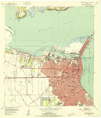
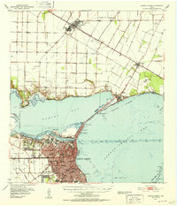
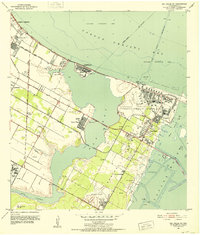
1951 Map of Portland
USGS Topo · Published 1952About this map
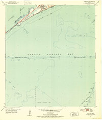
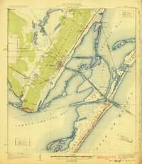
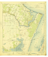
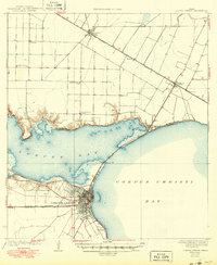
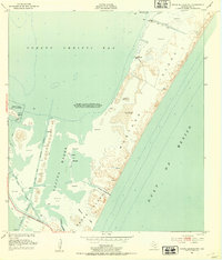
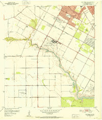
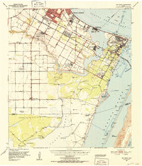
Portland sits at the strategic junction of Nueces Bay and Corpus Christi Bay, defined by the transportation corridors of the Southern Pacific railroad and the Nueces Bay Causeway. This 1951 survey illustrates a coastal landscape shaped by maritime industry and transit, with the deep-water Corpus Christi Ship Channel cutting across the bay and a dedicated Seaplane Restricted Area indicating military or aviation activity in the south. The hydrography reflects the complex underwater topography of the Texas coast, showing numerous hazards and landmarks for mariners such as Indian Reef, Alta Vista Reef, and Donnel Reef. Indian Point serves as the landward anchor for the causeway, marking the narrowest crossing between the bays. The map also records the precise administrative boundaries between Nueces and San Patricio Counties, which split the bay waters and the growing settlement of Portland.
Find a feature on this map
17 named features on this map. Tap any name to fly to it.
Don’t see what you’re looking for? This feature index may not catch every label — zoom into the map to look around manually.
Map Details
Editions of this 1951 Portland Map
This is the sole edition of this map. No revisions or reprints were ever made.
Other maps of this area
1925 · Aransas Pass
USGS Topo · 1:62,500
1925 · Oso Creek
USGS Topo · 1:62,500
1925 · Corpus Christi
USGS Topo · 1:62,500

1950 · Corpus Christi
USGS Topo · 1:250,000
1951 · Corpus Christi
USGS Topo · 1:24,000
1951 · Corpus Christi
USGS Topo · 1:62,500
1951 · Crane Islands NW
USGS Topo · 1:24,000
1951 · Oso Creek NW
USGS Topo · 1:24,000
1951 · Oso Creek NE
USGS Topo · 1:24,000
1951 · Oso Creek
USGS Topo · 1:62,500