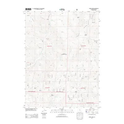
2013 Map of Corral Peaks
USGS Topo · Published 2013About this map
Arapaho National Forest dominates this high-altitude landscape of Grand County, where the Continental Divide's influence is seen in the intricate drainage systems and steep gulches. Cattle ranching and mountain transit define the area's human history, evidenced by the Wheatley Ranch and East Fork Cow Camp. The map documents a rugged network of water management and recreation trails, including the Musgrove Ditch and Scholl Reservoir, which sit below the prominent heights of Black Mountain and Grouse Mountain. Numerous named trails, such as Haypark Trail 60.1 and Elk Mountain Trail 27, thread through the timber and meadows of Hay Park and Buffalo Park. Geologically, the terrain is characterized by dramatic elevations like Corral Peaks and sharp drops into Cliff Gulch and Sawmill Gulch, providing a detailed record of the Colorado Rockies' headwater geography.
Find a feature on this map
71 named features on this map. Tap any name to fly to it.
Don’t see what you’re looking for? This feature index may not catch every label — zoom into the map to look around manually.
Map Details
Editions of this 2013 Corral Peaks Map
This is the sole edition of this map. No revisions or reprints were ever made.
Other maps of this area

1954 · Craig
USGS Topo · 1:250,000

1956 · Radial Mountain
USGS Topo · 1:24,000

1956 · Kremmling
USGS Topo · 1:62,500

1956 · Parkview Mountain
USGS Topo · 1:24,000

1956 · Hyannis Peak
USGS Topo · 1:24,000

1956 · Hyannis Peak
USGS Topo · 1:62,500

1956 · Rand
USGS Topo · 1:62,500

1957 · Craig
USGS Topo · 1:250,000

1957 · Hot Sulphur Springs
USGS Topo · 1:62,500

1958 · Craig
USGS Topo · 1:250,000