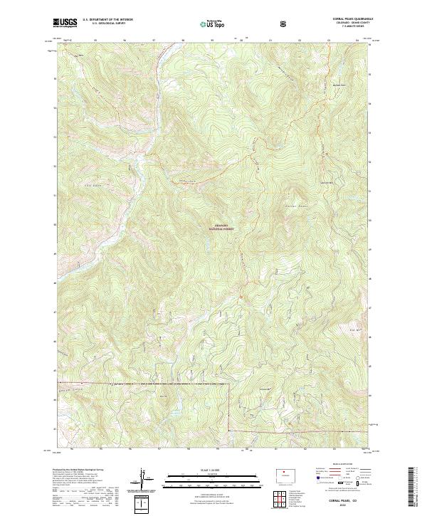
2022 Map of Corral Peaks
USGS Topo · Published 2022About this map
Arapaho National Forest dominates this section of the High Rockies, where a complex network of ridgelines and water management systems defines the local landscape. The presence of the Musgrave Ditch, which feeds into the Scholl Reservoir, reflects the area's long-standing reliance on high-altitude water engineering to support lower elevations. Peaks such as Corral Peaks, Searight Mtn, and Slide Mtn provide the topographic backbone of the region, interspersed with open meadows like Buffalo Park and Hay Park. Extensive backcountry access is documented via established routes such as the Troublesome Trl, Wheatley Creek Trl, and Buffalo Creek Trl. These trails follow the natural contours of drainages like E Fork Troublesome Cr and Coyote Cr, illustrating the historic paths used by ranchers and foresters throughout the twentieth century.
Find a feature on this map
40 named features on this map. Tap any name to fly to it.
Don’t see what you’re looking for? This feature index may not catch every label — zoom into the map to look around manually.
Map Details
Editions of this 2022 Corral Peaks Map
This is the sole edition of this map. No revisions or reprints were ever made.
Other maps of this area

1954 · Craig
USGS Topo · 1:250,000

1956 · Radial Mountain
USGS Topo · 1:24,000

1956 · Kremmling
USGS Topo · 1:62,500

1956 · Parkview Mountain
USGS Topo · 1:24,000

1956 · Hyannis Peak
USGS Topo · 1:24,000

1956 · Hyannis Peak
USGS Topo · 1:62,500

1956 · Rand
USGS Topo · 1:62,500

1957 · Craig
USGS Topo · 1:250,000

1957 · Hot Sulphur Springs
USGS Topo · 1:62,500

1958 · Craig
USGS Topo · 1:250,000