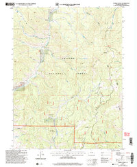
2000 Map of Corral Peaks
USGS Topo · Published 2004About this map
Arapaho National Forest dominates this mountain landscape, which was revised by the Forest Service just after the turn of the millennium. The terrain is defined by a dense network of high-elevation drainages including Troublesome Creek, Corral Creek, and the South Fork Buffalo Creek, which carve through the territory between Searight Mountain and Elk Mountain. Human presence is marked by historic ranching and transit sites like the Wheatley Ranch and the East Fork Cow Camp, connected by the Hay Park Trail and Elk Mountain Trail. The topography reveals the intricate drainage patterns of the Sulphur Ranger District, where numerous gulches such as Paradise Gulch and Slide Gulch descend from peaks like Black Mountain and Round Mountain. A Communication Site and isolated Drill Hole markers indicate modern technical utility within this otherwise primitive forest environment.
Find a feature on this map
33 named features on this map. Tap any name to fly to it.
Don’t see what you’re looking for? This feature index may not catch every label — zoom into the map to look around manually.
Map Details
Editions of this 2000 Corral Peaks Map
This is the sole edition of this map. No revisions or reprints were ever made.
Other maps of this area

1954 · Craig
USGS Topo · 1:250,000

1956 · Radial Mountain
USGS Topo · 1:24,000

1956 · Kremmling
USGS Topo · 1:62,500

1956 · Parkview Mountain
USGS Topo · 1:24,000

1956 · Hyannis Peak
USGS Topo · 1:24,000

1956 · Hyannis Peak
USGS Topo · 1:62,500

1956 · Rand
USGS Topo · 1:62,500

1957 · Craig
USGS Topo · 1:250,000

1957 · Hot Sulphur Springs
USGS Topo · 1:62,500

1958 · Craig
USGS Topo · 1:250,000