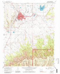
1965 Map of Cortez
USGS Topo · Published 1984About this map
Cortez serves as the focal point of the Montezuma Valley in the mid-1960s, showing a well-established town grid defined by Main St and Montezuma Ave. The map documents a significant concentration of civic and social infrastructure, including several educational institutions such as Calkins Jr High Sch and Manaugh Sch, alongside a regional Hosp and Armory. To the south and east, the landscape transitions into the high terrain of Mesa Verde National Park North Rim and the Ute Mountain Indian Reservation North Mesa, where the topography is defined by complex canyon systems like Navajo Canyon. Water management is prominent throughout the valley floor, with extensive ditch networks feeding into features like Totten Reservoir and Denny Lake, supporting an area that balances municipal growth with the expansive federal and tribal lands bordering the settlement.
Find a feature on this map
72 named features on this map. Tap any name to fly to it.
Don’t see what you’re looking for? This feature index may not catch every label — zoom into the map to look around manually.
Map Details
Editions of this 1965 Cortez Map
3 editions found
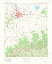
Other maps of this area

1912 · Soda Canyon
USGS Topo · 1:62,500

1915 · Soda Canyon
USGS Topo · 1:62,500

1956 · Cortez
USGS Topo · 1:250,000

1958 · Cortez SW
USGS Topo · 1:24,000

1958 · Cortez
USGS Topo · 1:250,000

1959 · Cortez
USGS Topo · 1:250,000

1962 · Cortez
USGS Topo · 1:250,000

1965 · Cortez
USGS Topo · 1:24,000

1965 · Dolores East
USGS Topo · 1:24,000

1965 · Dolores West
USGS Topo · 1:24,000