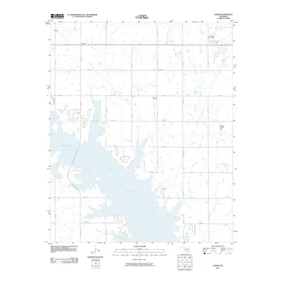
2010 Map of Corum
USGS Topo · Published 2010About this map
Waurika Lake dominates the southern landscape of this Stephens and Comanche County region, its irregular shoreline reaching into the prairie through numerous inlets and flooded drainages. The small settlement of Corum sits near the northern boundary, an area where the grid of sectional roads like Corum Rd and Friendship Rd reflects the rural development of southwestern Oklahoma. Genealogists will find the locations of Corum Cemetery and Diamond Cemetery particularly useful for tracing local family roots. Further east, the Cow Creek Site 34 Reservoir and its associated Cow Creek Site 34 Dam indicate managed water resources in the Dry Creek basin, while the Shelby Landing Strip provides a specific point of interest for local aviation history.
Find a feature on this map
28 named features on this map. Tap any name to fly to it.
Don’t see what you’re looking for? This feature index may not catch every label — zoom into the map to look around manually.
Map Details
Editions of this 2010 Corum Map
This is the sole edition of this map. No revisions or reprints were ever made.
Other maps of this area

1901 · Addington
USGS Topo · 1:125,000

1955 · Lawton
USGS Topo · 1:250,000

1957 · Hastings
USGS Topo · 1:62,500

1957 · Ardmore
USGS Topo · 1:250,000

1962 · Ryan
USGS Topo · 1:62,500

1962 · Temple
USGS Topo · 1:62,500

1963 · Ardmore
USGS Topo · 1:250,000

1964 · Duncan South
USGS Topo · 1:24,000

1964 · Comanche
USGS Topo · 1:24,000

1984 · Hooper
USGS Topo · 1:24,000