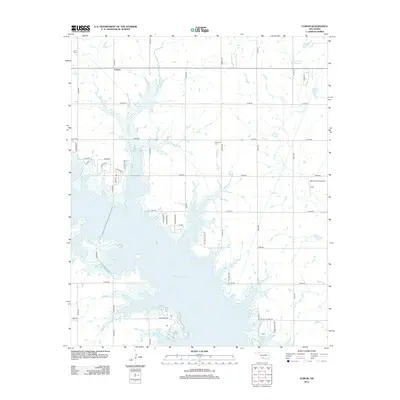
2012 Map of Corum
USGS Topo · Published 2012About this map
Waurika Lake dominates this southern Oklahoma landscape, its irregular shoreline reaching deep into the agricultural plains of Stephens and Comanche counties. The small settlement of Corum sits to the northwest, serving as a hub for the surrounding rural network of section-line roads such as Empire Rd and N2740 Rd. Local history is anchored by the Corum Cem and Diamond Cem, while newer residential developments like 12 Oaks and recreational access points along Kiowa Park Rd illustrate the area's transition toward lakefront living. The inclusion of KSA Orchards Airport and various reservoirs, including the Cow Cr Site 34 Reservoir, highlights a landscape managed for both aviation and water conservation in the early 21st century.
Find a feature on this map
41 named features on this map. Tap any name to fly to it.
Don’t see what you’re looking for? This feature index may not catch every label — zoom into the map to look around manually.
Map Details
Editions of this 2012 Corum Map
This is the sole edition of this map. No revisions or reprints were ever made.
Other maps of this area

1901 · Addington
USGS Topo · 1:125,000

1955 · Lawton
USGS Topo · 1:250,000

1957 · Hastings
USGS Topo · 1:62,500

1957 · Ardmore
USGS Topo · 1:250,000

1962 · Ryan
USGS Topo · 1:62,500

1962 · Temple
USGS Topo · 1:62,500

1963 · Ardmore
USGS Topo · 1:250,000

1964 · Duncan South
USGS Topo · 1:24,000

1964 · Comanche
USGS Topo · 1:24,000

1984 · Hooper
USGS Topo · 1:24,000