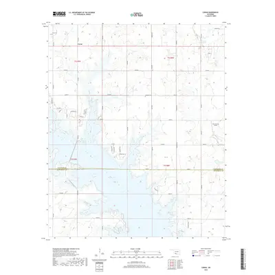
2018 Map of Corum
USGS Topo · Published 2018About this map
Waurika Lake dominates the southern landscape of this Oklahoma survey, its irregular fingers reaching into the surrounding prairie along the border of Stephens Co and Jefferson Co. The small settlement of Corum serves as a northern anchor for the area, situated near the intersection of N2740 Rd and several rural routes. Genealogists will find the Corum Cem and the more isolated Diamond Cem particularly valuable for tracing local family histories in this agricultural region.
Find a feature on this map
46 named features on this map. Tap any name to fly to it.
Don’t see what you’re looking for? This feature index may not catch every label — zoom into the map to look around manually.
Map Details
Editions of this 2018 Corum Map
This is the sole edition of this map. No revisions or reprints were ever made.
Other maps of this area

1901 · Addington
USGS Topo · 1:125,000

1955 · Lawton
USGS Topo · 1:250,000

1957 · Hastings
USGS Topo · 1:62,500

1957 · Ardmore
USGS Topo · 1:250,000

1962 · Ryan
USGS Topo · 1:62,500

1962 · Temple
USGS Topo · 1:62,500

1963 · Ardmore
USGS Topo · 1:250,000

1964 · Duncan South
USGS Topo · 1:24,000

1964 · Comanche
USGS Topo · 1:24,000

1984 · Hooper
USGS Topo · 1:24,000