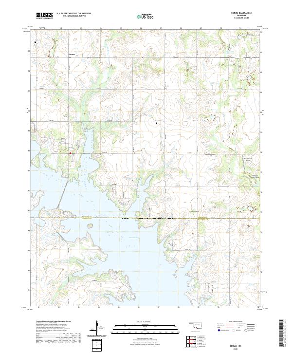
2022 Map of Corum
USGS Topo · Published 2022About this map
Waurika Lake dominates the southern half of this modern survey, where the waters submerge several creek valleys at the boundary between Stephens and Jefferson Counties. North of the reservoir, the rural landscape is defined by the small settlement of Corum and its namesake Corum Cemetery, alongside the Diamond Cemetery further east. The area retains its agrarian and aviation character, with private landing strips like KSA Orchards Airport and Wildlife Ranch Airport situated near the headwaters of Dry Creek. A network of section-line roads, such as E1840 Road and E1850 Road, provides access to residential developments like Hillcrest and Twelve Oaks Road that have clustered near the lake’s northern shoreline. The map also traces the winding course of Walker Creek as it feeds into the lake, illustrating the modern hydraulic management of the southern Oklahoma plains.
Find a feature on this map
39 named features on this map. Tap any name to fly to it.
Don’t see what you’re looking for? This feature index may not catch every label — zoom into the map to look around manually.
Map Details
Editions of this 2022 Corum Map
This is the sole edition of this map. No revisions or reprints were ever made.
Other maps of this area

1901 · Addington
USGS Topo · 1:125,000

1955 · Lawton
USGS Topo · 1:250,000

1957 · Hastings
USGS Topo · 1:62,500

1957 · Ardmore
USGS Topo · 1:250,000

1962 · Ryan
USGS Topo · 1:62,500

1962 · Temple
USGS Topo · 1:62,500

1963 · Ardmore
USGS Topo · 1:250,000

1964 · Duncan South
USGS Topo · 1:24,000

1964 · Comanche
USGS Topo · 1:24,000

1984 · Hooper
USGS Topo · 1:24,000