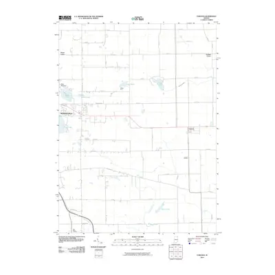
2010 Map of Corunna
USGS Topo · Published 2010About this map
Kendallville and Corunna anchor this northeastern Indiana landscape, where a dense grid of county roads connects the rural intersections of Wayne Center and Fairfield Center. The area's glacial geography is defined by numerous small water bodies and drainage systems, including Bixler Lake on the edge of the city and the winding course of Little Cedar Creek. For those researching local history or genealogy, the map provides precise locations for the Corunna Cemetery and Saint Marys Cemetery. Engineering and terrain are represented by features such as the Niezer Dam at Lake Maxler and the uniquely named Baby Mountain. This 2010 topographic record illustrates the persistent agrarian layout of the region, where water management through features like McCullough Ditch and Diehl Ditch remains critical to the land's utility.
Find a feature on this map
56 named features on this map. Tap any name to fly to it.
Don’t see what you’re looking for? This feature index may not catch every label — zoom into the map to look around manually.
Map Details
Editions of this 2010 Corunna Map
This is the sole edition of this map. No revisions or reprints were ever made.
Other maps of this area

1942 · Ashley
USGS Topo · 1:24,000

1942 · Stroh
USGS Topo · 1:24,000

1947 · Wolcottville
USGS Topo · 1:24,000

1953 · Fort Wayne
USGS Topo · 1:250,000

1955 · Corunna
USGS Topo · 1:24,000

1955 · Ege
USGS Topo · 1:24,000

1955 · Kendallville
USGS Topo · 1:24,000

1956 · Fort Wayne
USGS Topo · 1:250,000

1957 · Auburn
USGS Topo · 1:24,000

1957 · Waterloo
USGS Topo · 1:24,000