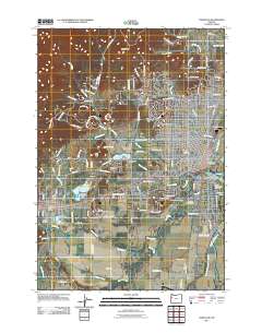
2011 Map of Corvallis
USGS Topo · Published 2011About this map
Oregon State University serves as a central anchor in this 2011 map of the Willamette Valley, where the academic campus meets the residential and industrial growth of Corvallis. To the west, the town of Philomath is clearly defined, connected to the city by a network of corridors including OR Highway 34 and US Highway 20. The landscape is a complex intersection of natural water systems and early 21st-century infrastructure, featuring the winding Marys River and the significant Willamette River eastern boundary.
Find a feature on this map
123 named features on this map. Tap any name to fly to it.
Don’t see what you’re looking for? This feature index may not catch every label — zoom into the map to look around manually.
Map Details
Editions of this 2011 Corvallis Map
This is the sole edition of this map. No revisions or reprints were ever made.
Other maps of this area

1911 · Inavale
USGS Topo · 1:31,680

1912 · Halsey
USGS Topo · 1:62,500

1913 · Philomath
USGS Topo · 1:31,680

1913 · Oakville
USGS Topo · 1:31,680

1913 · Wells
USGS Topo · 1:31,680

1914 · Soap Creek
USGS Topo · 1:31,680

1916 · Albany
USGS Topo · 1:62,500

1921 · Corvallis
USGS Topo · 1:62,500

1922 · Monroe
USGS Topo · 1:62,500

1939 · Monroe
USGS Topo · 1:62,500