1975 Map of Corvallis
USGS Topo · Published 1980About this map
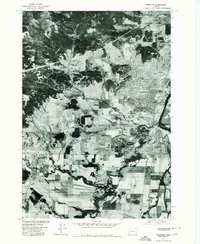
The growing city of Corvallis and the neighboring community of Philomath are captured during the mid-1970s in this orthophotoquad. Produced by the Geological Survey and the Soil Conservation Service, the imagery provides a direct visual record of the region's land use, from the dense residential and institutional blocks in the city center to the surrounding agricultural fields and forested foothills. The meandering Booneville Channel cuts through the lowlands to the southeast, highlighting the complex drainage patterns of the Willamette Valley floor. This particular survey was derived from aerial photography taken in September 1975, reflecting a transitional period of suburban expansion and timber-related activity before later decades of development further altered the landscape between these two Benton County hubs.
Find a feature on this map
3 named features on this map. Tap any name to fly to it.
Don’t see what you’re looking for? This feature index may not catch every label — zoom into the map to look around manually.
Map Details
Editions of this 1975 Corvallis Map
This is the sole edition of this map. No revisions or reprints were ever made.
Other maps of this area

1911 · Inavale
USGS Topo · 1:31,680

1912 · Halsey
USGS Topo · 1:62,500

1913 · Philomath
USGS Topo · 1:31,680

1913 · Oakville
USGS Topo · 1:31,680

1913 · Wells
USGS Topo · 1:31,680

1914 · Soap Creek
USGS Topo · 1:31,680

1916 · Albany
USGS Topo · 1:62,500

1921 · Corvallis
USGS Topo · 1:62,500

1922 · Monroe
USGS Topo · 1:62,500

1939 · Monroe
USGS Topo · 1:62,500