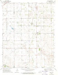
1972 Map of Corwin
USGS Topo · Published 1975About this map
The Old Indian Treaty Boundary cuts a prominent east-west line across this landscape, marking a significant historical division in Southern Kansas near the Oklahoma border. The small settlement of Corwin serves as a local hub along the Missouri Pacific railroad, which bisects the terrain alongside an extensive network of pipelines and a dedicated Compressor Station.
Find a feature on this map
18 named features on this map. Tap any name to fly to it.
Don’t see what you’re looking for? This feature index may not catch every label — zoom into the map to look around manually.
Map Details
Editions of this 1972 Corwin Map
This is the sole edition of this map. No revisions or reprints were ever made.
Other maps of this area

1889 · Anthony
USGS Topo · 1:125,000

1891 · Anthony
USGS Topo · 1:125,000

1955 · Woodward
USGS Topo · 1:250,000

1955 · Pratt
USGS Topo · 1:250,000

1958 · Woodward
USGS Topo · 1:250,000

1959 · Pratt
USGS Topo · 1:250,000

1969 · Amorita
USGS Topo · 1:24,000

1969 · Burlington
USGS Topo · 1:24,000
1969 · Manchester NW
USGS Topo · 1:24,000

1972 · Attica
USGS Topo · 1:24,000