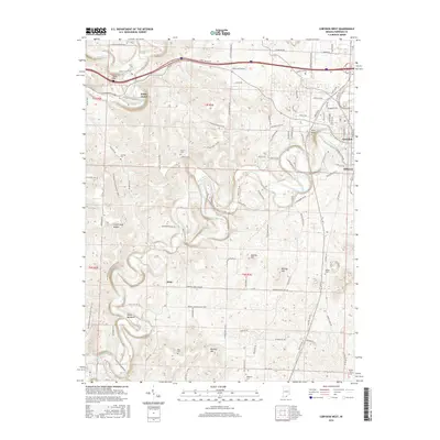
2016 Map of Corydon West
USGS Topo · Published 2016About this map
Indian Creek carves a winding path through the landscape west of Corydon, defining the terrain of Harrison County. This 2016 survey shows the intricate relationship between the river's bends and the local topography, featuring prominent rises like Pilot Knob and the sharp ridge of the Devils Backbone. The map documents established communities such as White Cloud and Dixie, while preserving the locations of numerous family and community burial grounds including Conrad Cem, Trout Cem, and Jordan Cem. To the north, the Blue River flows past Scout Mtn, near the large resurgence at Harrison Spring. The road network, including the historic Old State Rd 135 and winding paths like Fairview Church Rd SW, reflects the rural settlement patterns that have shaped this portion of southern Indiana for generations.
Find a feature on this map
134 named features on this map. Tap any name to fly to it.
Don’t see what you’re looking for? This feature index may not catch every label — zoom into the map to look around manually.
Map Details
Editions of this 2016 Corydon West Map
This is the sole edition of this map. No revisions or reprints were ever made.
Other maps of this area

1931 · Corydon
USGS Topo · 1:62,500

1944 · Corydon West
USGS Topo · 1:24,000

1946 · Leavenworth
USGS Topo · 1:24,000

1946 · Depauw
USGS Topo · 1:24,000

1947 · Leavenworth
USGS Topo · 1:24,000

1947 · Corydon West
USGS Topo · 1:24,000

1947 · Mauckport
USGS Topo · 1:24,000

1948 · Corydon East
USGS Topo · 1:24,000

1948 · Milltown
USGS Topo · 1:24,000

1948 · Laconia
USGS Topo · 1:24,000