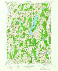
1944 Map of Cossayuna
USGS Topo · Published 1966About this map
Cossayuna Lake anchors this 1944 landscape, a significant water body surrounded by a network of rural hamlets and family-named landmarks. The village of Argyle stands at the northwestern corner, while small clusters like Cossayuna and South Argyle serve as local hubs for the surrounding farmsteads. The southern portion of the quadrangle is defined by the Batten Kill river valley, where the Greenwich and Johnsonville railroad follows the water's path through East Greenwich and Fitch Point.
Find a feature on this map
39 named features on this map. Tap any name to fly to it.
Don’t see what you’re looking for? This feature index may not catch every label — zoom into the map to look around manually.
Map Details
Editions of this 1944 Cossayuna Map
Other maps of this area

1893 · Fort Ann
USGS Topo · 1:62,500

1895 · Cambridge
USGS Topo · 1:62,500

1895 · Fort Ann
USGS Topo · 1:62,500

1895 · Glens Falls
USGS Topo · 1:62,500

1897 · Glens Falls
USGS Topo · 1:62,500

1898 · Cambridge
USGS Topo · 1:62,500

1898 · Fort Ann
USGS Topo · 1:62,500

1900 · Schuylerville
USGS Topo · 1:62,500

1901 · Fort Ann
USGS Topo · 1:62,500

1901 · Cambridge
USGS Topo · 1:62,500