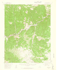
1959 Map of Cotopaxi
USGS Topo · Published 1961About this map
The Arkansas River carves a deep path through this mid-century Colorado landscape, serving as the primary corridor for the Denver and Rio Grande Western Railroad. The settlement of Cotopaxi sits at the junction of several drainage gulches, functioning as a focal point for the surrounding high-altitude terrain. Local industry and infrastructure are evident in the presence of an Iron Quarry and smaller mines scattered among the peaks, reflecting the area's extractive history.
Find a feature on this map
65 named features on this map. Tap any name to fly to it.
Don’t see what you’re looking for? This feature index may not catch every label — zoom into the map to look around manually.
Map Details
Editions of this 1959 Cotopaxi Map
5 editions found

Other maps of this area

1889 · Canon City
USGS Topo · 1:125,000

1892 · Canon City
USGS Topo · 1:125,000

1894 · Pikes Peak
USGS Topo · 1:125,000

1901 · Pikes Peak
USGS Topo · 1:125,000

1942 · Cover Mtn.
USGS Topo · 1:62,500

1948 · Cover Mtn.
USGS Topo · 1:62,500

1950 · Valley View Hot Springs
USGS Topo · 1:24,000

1954 · Pueblo
USGS Topo · 1:250,000

1955 · Westcliffe
USGS Topo · 1:24,000

1956 · Cameron Mountain
USGS Topo · 1:62,500