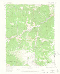
1959 Map of Cotopaxi
USGS Topo · Published 1968About this map
Cotopaxi sits at the junction of rail and river, serving as a focal point for this 1950s survey of the Arkansas River valley. The presence of the Denver and Rio Grande Western Railroad underscores the corridor's importance for transportation through the high country. In the southern portion of the quadrangle, the community of Hillside is documented with its local infrastructure, including the Hillside Sch and Hillside Cem near Wet Mountain Creek.
Find a feature on this map
77 named features on this map. Tap any name to fly to it.
Don’t see what you’re looking for? This feature index may not catch every label — zoom into the map to look around manually.
Map Details
Editions of this 1959 Cotopaxi Map
5 editions found

Other maps of this area

1889 · Canon City
USGS Topo · 1:125,000

1892 · Canon City
USGS Topo · 1:125,000

1894 · Pikes Peak
USGS Topo · 1:125,000

1901 · Pikes Peak
USGS Topo · 1:125,000

1942 · Cover Mtn.
USGS Topo · 1:62,500

1948 · Cover Mtn.
USGS Topo · 1:62,500

1950 · Valley View Hot Springs
USGS Topo · 1:24,000

1954 · Pueblo
USGS Topo · 1:250,000

1955 · Westcliffe
USGS Topo · 1:24,000

1956 · Cameron Mountain
USGS Topo · 1:62,500