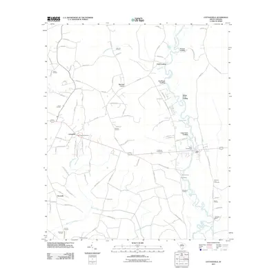
2011 Map of Cottageville
USGS Topo · Published 2011About this map
The Edisto River meanders through this portion of Colleton County, defining a landscape shaped by river access and rural crossroads. The town of Cottageville serves as a primary hub, centered near the Cottageville Post Office and the Cottageville Lookout Tower. Numerous landings along the river, including Prices Landing, Goodhope Landing, and Long Creek Landing, indicate the enduring importance of the waterway for local transport and recreation.
Find a feature on this map
95 named features on this map. Tap any name to fly to it.
Don’t see what you’re looking for? This feature index may not catch every label — zoom into the map to look around manually.
Map Details
Editions of this 2011 Cottageville Map
This is the sole edition of this map. No revisions or reprints were ever made.
Other maps of this area

1918 · Walterboro
USGS Topo · 1:62,500

1918 · Cottageville
USGS Topo · 1:62,500

1919 · Ridgeville
USGS Topo · 1:48,000

1920 · Ridgeville
USGS Topo · 1:62,500

1920 · St. George
USGS Topo · 1:48,000

1921 · St. George
USGS Topo · 1:62,500

1943 · Cottageville
USGS Topo · 1:62,500

1943 · Orangeburg
USGS Topo · 1:125,000

1943 · Walterboro
USGS Topo · 1:62,500

1943 · Ridgeville
USGS Topo · 1:62,500