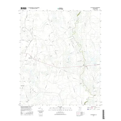
2017 Map of Cottageville
USGS Topo · Published 2017About this map
The Edisto River carves a winding path along the eastern border of this Colleton County region, defining a landscape of wetlands and river bluffs. Near Harts Bluff and Leveston Bluff, the terrain shifts from the dense hydrologic networks of Big Bay Swamp and Spooler Swamp to higher ground where the town of Cottageville serves as a central hub. The area is notable for its extensive collection of family and community burial grounds, such as Hughes Cem, Ackerman Cem, and Round O Cem, which reflect the deep-rooted local genealogy of the rural Lowcountry. A complex web of secondary roads like McDanieltown Rd and Rehoboth Rd connects these settlements and landmarks, while natural features like Warrens Savanna and Logging Savanna highlight the historical importance of the local timber and savanna environments.
Find a feature on this map
104 named features on this map. Tap any name to fly to it.
Don’t see what you’re looking for? This feature index may not catch every label — zoom into the map to look around manually.
Map Details
Editions of this 2017 Cottageville Map
This is the sole edition of this map. No revisions or reprints were ever made.
Other maps of this area

1918 · Walterboro
USGS Topo · 1:62,500

1918 · Cottageville
USGS Topo · 1:62,500

1919 · Ridgeville
USGS Topo · 1:48,000

1920 · Ridgeville
USGS Topo · 1:62,500

1920 · St. George
USGS Topo · 1:48,000

1921 · St. George
USGS Topo · 1:62,500

1943 · Cottageville
USGS Topo · 1:62,500

1943 · Orangeburg
USGS Topo · 1:125,000

1943 · Walterboro
USGS Topo · 1:62,500

1943 · Ridgeville
USGS Topo · 1:62,500