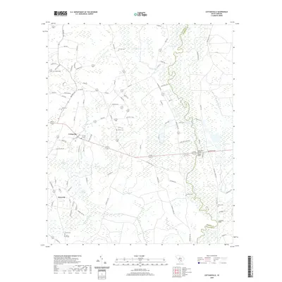
2020 Map of Cottageville
USGS Topo · Published 2020About this map
The Edisto River meanders along the eastern border of Colleton County, defining a landscape of low-lying wetlands and established rural settlements. Cottageville serves as the central hub of this area, where several regional routes converge near the upper reaches of Craven Br. The terrain is characterized by expansive swampy areas including Big Bay Swamp and Spooler Swamp, which alternate with pockets of open land known locally as savannas, such as Warrens Savanna and Logging Savanna. Family names are deeply etched into the geography through numerous burial grounds like Ackerman Cem, Adams Cem, and Williams Cem, reflecting generations of local residency. Notable river features like Harts Bluff and Leveston Bluff mark elevated points along the river's winding path, while Parker Hole suggests a specific historical use of the waterway's natural depth.
Find a feature on this map
102 named features on this map. Tap any name to fly to it.
Don’t see what you’re looking for? This feature index may not catch every label — zoom into the map to look around manually.
Map Details
Editions of this 2020 Cottageville Map
This is the sole edition of this map. No revisions or reprints were ever made.
Other maps of this area

1918 · Walterboro
USGS Topo · 1:62,500

1918 · Cottageville
USGS Topo · 1:62,500

1919 · Ridgeville
USGS Topo · 1:48,000

1920 · Ridgeville
USGS Topo · 1:62,500

1920 · St. George
USGS Topo · 1:48,000

1921 · St. George
USGS Topo · 1:62,500

1943 · Cottageville
USGS Topo · 1:62,500

1943 · Orangeburg
USGS Topo · 1:125,000

1943 · Walterboro
USGS Topo · 1:62,500

1943 · Ridgeville
USGS Topo · 1:62,500