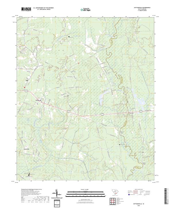
2024 Map of Cottageville
USGS Topo · Published 2024About this map
The Edisto River winds through the Lowcountry landscape, forming a natural boundary between Colleton and Dorchester counties. This coastal plain environment is defined by extensive wetlands, including Big Bay Swamp and Spooler Swamp, alongside smaller basins like Warrens Savanna and Logging Savanna. The settlement of Cottageville serves as a central hub, connected to the surrounding countryside by an intricate network of local roads such as Spelltown Rd and Old Beech Hill Rd.
Find a feature on this map
111 named features on this map. Tap any name to fly to it.
Don’t see what you’re looking for? This feature index may not catch every label — zoom into the map to look around manually.
Map Details
Editions of this 2024 Cottageville Map
This is the sole edition of this map. No revisions or reprints were ever made.
Other maps of this area

1918 · Walterboro
USGS Topo · 1:62,500

1918 · Cottageville
USGS Topo · 1:62,500

1919 · Ridgeville
USGS Topo · 1:48,000

1920 · Ridgeville
USGS Topo · 1:62,500

1920 · St. George
USGS Topo · 1:48,000

1921 · St. George
USGS Topo · 1:62,500

1943 · Cottageville
USGS Topo · 1:62,500

1943 · Orangeburg
USGS Topo · 1:125,000

1943 · Walterboro
USGS Topo · 1:62,500

1943 · Ridgeville
USGS Topo · 1:62,500