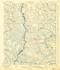
1918 Map of Cottageville
USGS Topo · Published 1943About this map
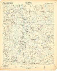
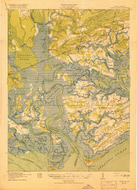
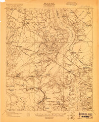
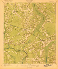
The Edisto River carves a winding path through the lowcountry at the convergence of Colleton, Dorchester, and Charleston counties, defining a landscape of dense riverbottom swamps and isolated landings. This 1918 survey documents a river-based economy dependent on a network of water access points like Norman Landing, Martin Landing, and Fishburn Landing. Extensive wetlands such as Big Swamp, Jeffries Swamp, and Caw Caw Swamp hem in the agricultural plateaus, where small settlements like Cottageville and Jacksonboro serve as hubs for the surrounding rural population.
Find a feature on this map
76 named features on this map. Tap any name to fly to it.
Don’t see what you’re looking for? This feature index may not catch every label — zoom into the map to look around manually.
Map Details
Editions of this 1918 Cottageville Map
3 editions found
Other maps of this area

1918 · Walterboro
USGS Topo · 1:62,500

1918 · Green Pond
USGS Topo · 1:62,500

1918 · Cottageville
USGS Topo · 1:62,500

1919 · Summerville
USGS Topo · 1:48,000
1919 · Edisto Island
USGS Topo · 1:62,500
1919 · Ridgeville
USGS Topo · 1:48,000

1919 · Wadmelaw Island
USGS Topo · 1:62,500

1920 · Ravenels
USGS Topo · 1:62,500
1920 · Ridgeville
USGS Topo · 1:62,500

1920 · St. George
USGS Topo · 1:48,000