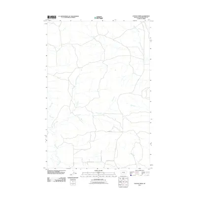
2011 Map of Cotton Creek
USGS Topo · Published 2011About this map
Cotton Creek and its many tributaries, including the North Fork Cotton Creek, carve a drainage network through this section of Yellowstone County. The landscape is defined by the headwaters of several drainages, such as Pompeys Pillar Creek and Rock Creek, which flow through an area marked by a sparse but organized road system. Local routes like Otis Creek Rd and the aptly named Pleasant Hollow Trl provide access to the rural terrain between Razor Creek and Cabin Creek. This 2011 survey illustrates the modern transition of the area from purely ranch-oriented roads to more descriptive residential naming conventions, as seen with Peaceful Plateau Trl and EW Tenny Rd.
Find a feature on this map
11 named features on this map. Tap any name to fly to it.
Don’t see what you’re looking for? This feature index may not catch every label — zoom into the map to look around manually.
Map Details
Editions of this 2011 Cotton Creek Map
This is the sole edition of this map. No revisions or reprints were ever made.
Other maps of this area

1893 · Huntley
USGS Topo · 1:125,000

1954 · Billings
USGS Topo · 1:250,000

1954 · Roundup
USGS Topo · 1:250,000

1956 · Rattlesnake Butte
USGS Topo · 1:24,000

1956 · Huntley
USGS Topo · 1:24,000

1957 · Billings
USGS Topo · 1:250,000

1958 · Billings
USGS Topo · 1:250,000

1958 · Roundup
USGS Topo · 1:250,000

1967 · Worden
USGS Topo · 1:24,000

1979 · Roundup
USGS Topo · 1:100,000