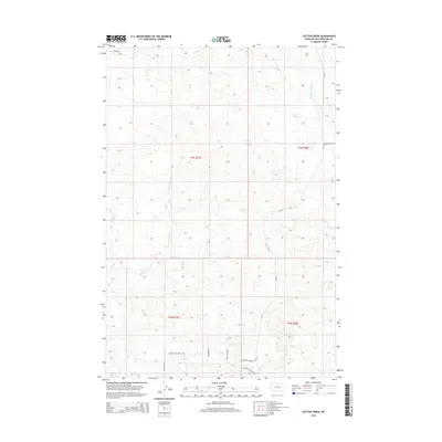
2014 Map of Cotton Creek
USGS Topo · Published 2014About this map
Pompeys Pillar Cr drains the high country of Yellowstone County in this 2014 topographic study, where the landscape is defined by a dense network of intermittent drainage and upland divides. The territory is dominated by the basin of Cotton Creek, including its significant northern tributary, N Fork Cotton Cr. This environment of coulees and ridges is navigated by a system of rural routes and trails that suggest a pattern of ranching and land management. Distinctive pathways like the Pleasant Hollow Trl and Peaceful Plateau Trl skirt the topography, while Lambert Trail Rd and Otis Creek Rd provide vital access points through the township sections of T4N R28E and T3N R27E. The map detail reflects a modern era of precise surveying, showing the intricate relationship between the watershed and the local road network, including the courses of Razor Cr and Rock Cr.
Find a feature on this map
19 named features on this map. Tap any name to fly to it.
Don’t see what you’re looking for? This feature index may not catch every label — zoom into the map to look around manually.
Map Details
Editions of this 2014 Cotton Creek Map
This is the sole edition of this map. No revisions or reprints were ever made.
Other maps of this area

1893 · Huntley
USGS Topo · 1:125,000

1954 · Billings
USGS Topo · 1:250,000

1954 · Roundup
USGS Topo · 1:250,000

1956 · Rattlesnake Butte
USGS Topo · 1:24,000

1956 · Huntley
USGS Topo · 1:24,000

1957 · Billings
USGS Topo · 1:250,000

1958 · Billings
USGS Topo · 1:250,000

1958 · Roundup
USGS Topo · 1:250,000

1967 · Worden
USGS Topo · 1:24,000

1979 · Roundup
USGS Topo · 1:100,000