
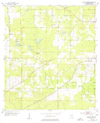
1954 Map of Cotton Plant
USGS Topo · Published 1955About this map
The agrarian and railway landscape of Marion County is defined by the intersection of the Atlantic Coast Line and the Seaboard Air Line, which anchor the small settlements of the region. This mid-century survey captures a network of rural communities including Cotton Plant, Martel, and York, where the local economy is evidenced by scattered Gravel Pits and a solitary Mine in the northwest. The terrain is a karst-influenced expanse of seasonal basins and sinkhole ponds, most notably Sturgis Prairie and Hog Pond, which are surrounded by numerous family-named water bodies like Sanders Pond and Coleman Pond. Social life centers on historically significant rural congregations such as Mars Hill Ch, Siloam Ch, and Friendship Ch. The map reflects a period before the rapid modernization of central Florida, preserving the locations of early schools and community nodes like Fellowship and Mt Olive.
Find a feature on this map
29 named features on this map. Tap any name to fly to it.
Don’t see what you’re looking for? This feature index may not catch every label — zoom into the map to look around manually.
Map Details
Editions of this 1954 Cotton Plant Map
2 editions found
Other maps of this area

1892 · Dunnellon
USGS Topo · 1:62,500

1893 · Citra
USGS Topo · 1:62,500

1894 · Dunnellon
USGS Topo · 1:62,500

1895 · Williston
USGS Topo · 1:62,500

1895 · Citra
USGS Topo · 1:62,500

1895 · Ocala
USGS Topo · 1:62,500

1954 · Romeo
USGS Topo · 1:24,000

1954 · Dunnellon
USGS Topo · 1:24,000

1954 · Dunnellon SE
USGS Topo · 1:24,000

1954 · Dunnellon
USGS Topo · 1:62,500