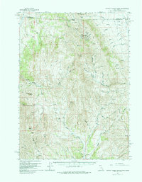
1959 Map of Cotton Thomas Basin
USGS Topo · Published 1988About this map
Mines and tunnels dominate the high ridges along the border of Utah and Idaho on this late 1950s survey. The landscape is defined by the extraction of minerals in the northern reaches, where the Vipont Mine and Skoro Mine are situated near a cluster of subterranean works, including the Phelan Tunnel and Harrison Tunnel. This remote high-desert terrain is marked by significant topographical landmarks like the Twin Peaks and the narrow passage at Devils Gate. Further south, the drainage patterns of Cotton Thomas Basin and Grouse Creek carve through the Grouse Creek Mountains, revealing a network of remote jeep trails that provided the only access to these isolated claims and summits like Beatty Mtn.
Find a feature on this map
71 named features on this map. Tap any name to fly to it.
Don’t see what you’re looking for? This feature index may not catch every label — zoom into the map to look around manually.
Map Details
Editions of this 1959 Cotton Thomas Basin Map
2 editions found
Other maps of this area

1954 · Pocatello
USGS Topo · 1:250,000

1954 · Brigham City
USGS Topo · 1:250,000

1955 · Twin Falls
USGS Topo · 1:250,000

1955 · Wells
USGS Topo · 1:250,000

1958 · Wells
USGS Topo · 1:250,000

1958 · Twin Falls
USGS Topo · 1:250,000

1958 · Pocatello
USGS Topo · 1:250,000

1958 · Brigham City
USGS Topo · 1:250,000

1959 · Cotton Thomas Basin
USGS Topo · 1:62,500

1959 · Yost
USGS Topo · 1:62,500